Archipelagos

  • English
  • Ελληνικα
Ποιοί Eίμαστε
Το ΑρχιπέλαγοςΤο Αρχιπέλαγος
Ποιοί ΕίμαστεΠοιοί Είμαστε
Ερευνητικές ΒάσειςΕρευνητικές Βάσεις
Ερευνητικά ΣκάφηΕρευνητικά Σκάφη
ΕξοπλισμόςΕξοπλισμός
ΣυνεργάτεςΣυνεργάτες
ΥποστηρικτέςΥποστηρικτές
Πεδία Δράσης
Θαλάσσια Προστασία
Αλιεία
Kίνδυνος Θαλάσσιου Ατυχήματος
Λιβάδια Ποσειδωνίας
Παράκτια Οικοσυστήματα
Προστασία των Κοραλλιγενών Οικοτόπων
Θαλάσσιες Χελώνες
Θαλάσσια Θηλαστικά
Δελφίνια
Φάλαινες
Φώκιες
Χερσαία Προστασία
Νησιωτική Πανίδα
Δάση και Χλωρίδα
Οικοσυστήματα Εσωτερικών Υδάτων
Κιβωτός Σπόρων Αιγαίου
Εργαστηριακή Έρευνα
Μικροπλαστικά
Ποιότητα Νερού
Ποιότητα Εδάφους
Projects
Καταφύγιο Θαλάσσιας Ζωής Αιγαίου
Ημερολόγιο Εργασίας
Save the Aegean
Υλικό
Υλικό Ευαισθητοποίησης
Videos
Δημοσιεύσεις
Συμμετοχή
Internships
Remote Internships
Ημερολόγιο Εργασίας
Καλοκαιρινό Σχολείο
Νέα
Συνάντηση Υπουργών Αλιείας στη Μάλτα – Μεγάλη ανησυχία για το μέλλον της αλιείας
Η ανοιχτή χωματερή γύρω μας που παριστάνουμε ότι δεν την βλέπουμε
Αειφόρα αγκυροβόλια: Έμπρακτη λύση για την ανάσχεση της καταστροφής των λιβαδιών Ποσειδωνίας
Μία ειδυλλιακή εικόνα ή μία εικόνα αυτοκαταστροφής για τις πολυτελείς διακοπές μιας μειοψηφίας;
View All...
Επικοινωνία
Δωρεά
Menu

Using GIS and Remote Sensing for Conservation

Using GIS and Remote Sensing for Conservation

by Aanastasia Miliou / Πέμπτη, 28 Νοεμβρίου 2019 / Published in Intern Experience, Ημερολόγιο Εργασίας, Ομάδα GIS

We (Emma, Casey, and Luciana) have now been working on the GIS Team at Archipelagos for the past eight weeks, allowing for the opportunity to work on many interesting projects. We all arrived around the same time at Archipelagos and it has been very beneficial to collaborate and exchange ideas and knowledge when tackling new projects.

We decided to intern at Archipelagos after hearing about the different conservation work that takes place in the institute. It seemed to be a great place to learn and use the principles of conservation mapping while using our previous GIS skills in an international environment.

When arriving here, we were amazed by the number of different projects there were and the variety of methods that we would be learning to use. The projects that we are working on, aim to understand the location of different species using remote sensing and GIS data in order to centre conservation efforts onto these specific areas.


Posidonia oceanica Distribution

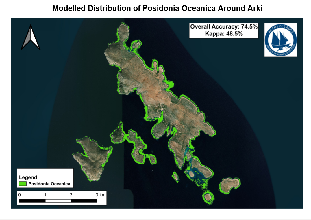
The main project that the GIS team has been working on is the mapping of Posidonia oceanica which is a species of seagrass that is found to abundantly grow in the Aegean Sea with many environmental benefits. Our method aims to map the location of P. oceanica in the Aegean Sea with higher accuracy than previous maps.

The technique we used combines  Sentinel-2A satellite imagery with ground truth data collected using DownScan sonar on kayak and boat surveys and image classification techniques. Many of the nearby islands have been previously mapped by interns at Archipelagos. However, the island of Arki could be remapped using this technique in an effort to increase the accuracy of the mapping. After using this methodology, the accuracy coverage of P. oceanica around the island of Arki had improved. Partaking in kayak surveys has allowed us to plan and experience applied GIS techniques in the field.


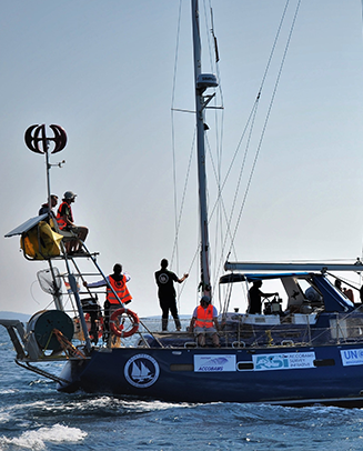
Marine Mammal Boat Survey Transects

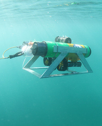
Emma and Casey, two of the three GIS interns, have been working on producing transects for the Marine Mammal Teams boat surveys to improve the scientific output from each boat survey. To ensure full coverage of the Aegean Sea surrounding Lipsi and Samos, the transects were produced using software called ‘Distance’ which allows for transects to be made according to specific parameters. The transects are already being used and produced sightings of Loggerhead Sea Turtles (Caretta caretta) and Common Bottlenose Dolphins (Tursiops truncatus).


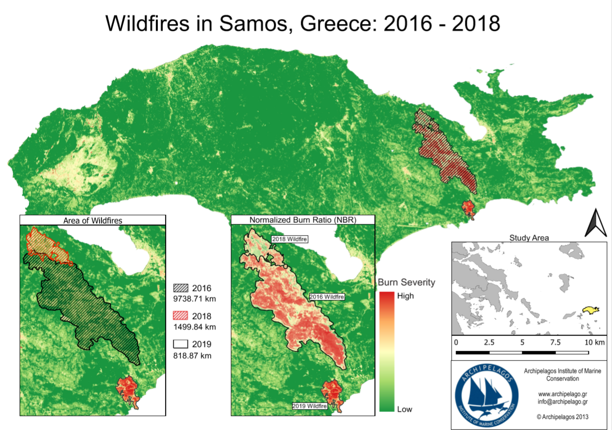
Wildfire Mapping using Sentinel-2 Satellite Imagery

Additionally, we have been working on mapping recent wildfires that took place on Samos in order to understand the extent of fire damage. Sentinel-2A data recorded recently after the wildfires was used for locating the wildfires. The damaged areas were calculated using the Normalized Burn Ratio. As a result, we were able to grasp the degree of damage that occurred in the areas of Samos which were affected by wildfires and use the data for future monitoring of these areas.


Coralligenous Mapping

Lastly, we have contributed to writing a literature review about coralligenous habitats. The main purpose of the literature review is to better understand coralligenous assemblages and their distribution. We have brought together past studies and synthesised their methodologies to better understand best practice for mapping coralligenous ourselves. We also gathered knowledge on protective legislation and new research branches relating to coralligenous reefs in order to have a well-rounded scope and grasp of all that mapping coralligenous entails.

Overall, we have greatly enjoyed working on these projects and hope to spend the rest of our internships here continuing to help with a diverse array of conservation efforts.


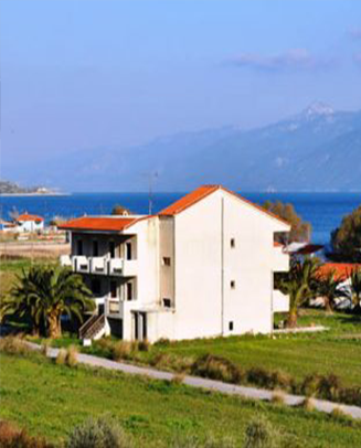
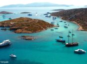
Island Life on Lipsi

Aside from the projects, it has also been great living on the island of Lipsi. This island is full of picturesque beaches and many hikes to explore at the weekend. Our research base is in the town of Lipsi and so everything we need is on our doorstep. The island also has a very strong sense of community and the villagers are very welcoming to all the volunteers with events such as weekly Greek dance and language lessons.


Emma Carroll, BSc Geology and Physical Geography, University of Edinburgh

Casey Ahlborn, BSc Geography, University of Minessota

Luciana Bertucci, Bachelor in Engineering, University of Mississippi 

0
0
0
0
0

What you can read next

Assessing the Seagrass Health in the Aegean Islands
“Blue Carbon”: Studying the Seagrass Capacity to Store Carbon
Posidonia Oceanica Mapping in the Southeastern Aegean Sea

HIGHLIGHTS

  • Διεθνείς Επισκέπτες στο υπό Δημιουργία Καταφύγιο Θαλάσσιας Ζωής Αιγαίου

    Διεθνείς Επισκέπτες στο υπό Δημιουργία Καταφύγιο Θαλάσσιας Ζωής Αιγαίου

    1 Ιουνίου 2021
    Το Ινστιτούτο Θαλάσσιας Προστασίας Αρχιπέλαγος επισκέφθηκαν χθες στο νησί των …
  • Απονομή του Βραβείου Ευκράντη στο Ινστιτούτο Θαλάσσιας Προστασίας Αρχιπέλαγος

    Απονομή του Βραβείου Ευκράντη στο Ινστιτούτο Θαλάσσιας Προστασίας Αρχιπέλαγος

    27 Ιουλίου 2020
    Ιδιαίτερη τιμή και ηθική στήριξη για όλους όσους απαρτίζουν το …
  • Επίσκεψη της Προέδρου της Δημοκρατίας στο σκάφος Aegean Explorer του Ινστιτούτου Θαλάσσιας Προστασίας «Αρχιπέλαγος»

    Επίσκεψη της Προέδρου της Δημοκρατίας στο σκάφος Aegean Explorer του Ινστιτούτου Θαλάσσιας Προστασίας «Αρχιπέλαγος»

    30 Ιουνίου 2020
    Στο πλαίσιο της χθεσινής επίσκεψης της Πρόεδρου της Δημοκρατίας στο …
  • Παρουσίαση ταινίας για το Καταφύγιο Θαλάσσιας Ζωής Αιγαίου

    Παρουσίαση ταινίας για το Καταφύγιο Θαλάσσιας Ζωής Αιγαίου

    11 Φεβρουαρίου 2020
    Στις 14 Φεβρουαρίου στο πλαίσιο του World Whale Film Festival, …
  • Βράβευση απένειμε προς στο Ινστιτούτο Αρχιπέλαγος το International Propeller Club of the United States

    Βράβευση απένειμε προς στο Ινστιτούτο Αρχιπέλαγος το International Propeller Club of the United States

    6 Φεβρουαρίου 2020
    Θα θέλαμε να ευχαριστήσουμε το International Propeller Club of the …

Recent Posts

  • Συνάντηση Υπουργών Αλιείας στη Μάλτα – Μεγάλη ανησυχία για το μέλλον της αλιείας

    Συνάντηση Υπουργών Αλιείας στη Μάλτα – Μεγάλη ανησυχία για το μέλλον της αλιείας

    16 Οκτωβρίου 2023
    Ολοκληρώθηκε στην Μάλτα την προηγούμενη εβδομάδα η συνάντηση των Υπουργών …
  • Η ανοιχτή χωματερή γύρω μας που παριστάνουμε ότι δεν την βλέπουμε

    Η ανοιχτή χωματερή γύρω μας που παριστάνουμε ότι δεν την βλέπουμε

    18 Σεπτεμβρίου 2023
    Με τις περιφερειακές και δημοτικές εκλογές να πλησιάζουν, στο σύνολο …
  • Αειφόρα αγκυροβόλια: Έμπρακτη λύση για την ανάσχεση της καταστροφής των λιβαδιών Ποσειδωνίας

    Αειφόρα αγκυροβόλια: Έμπρακτη λύση για την ανάσχεση της καταστροφής των λιβαδιών Ποσειδωνίας

    1 Σεπτεμβρίου 2023
    Αειφόρα αγκυροβόλια: Έμπρακτη λύση για την ανάσχεση της καταστροφής των …
  • Μία ειδυλλιακή εικόνα ή μία εικόνα αυτοκαταστροφής για τις πολυτελείς διακοπές μιας μειοψηφίας;

    Μία ειδυλλιακή εικόνα ή μία εικόνα αυτοκαταστροφής για τις πολυτελείς διακοπές μιας μειοψηφίας;

    21 Αυγούστου 2023
    Τέλη Αυγούστου σε ένα νησιωτικό σύμπλεγμα στα βόρεια Δωδεκάνησα, όπου …
  • Φυτεύοντας Υποβρύχιους Κήπους Ποσειδωνίας – μια νέα καινοτόμος διαδικασία φύτευσης

    Φυτεύοντας Υποβρύχιους Κήπους Ποσειδωνίας – μια νέα καινοτόμος διαδικασία φύτευσης

    29 Ιουνίου 2023
    Μία ιδιαίτερα καινοτόμος διαδικασία φύτευσης υποβρύχιων κήπων Ποσειδωνίας (P. oceanica) …
  • Οι Θανατώσεις Ζωνοδέλφινων στο ΒΑ Αιγαίο Συνεχίζονται

    Οι Θανατώσεις Ζωνοδέλφινων στο ΒΑ Αιγαίο Συνεχίζονται

    31 Μαΐου 2023
    Δύο ακόμα θανατωμένα ζωνοδέλφινα (Stenella coeruleoalba), εντοπίστηκαν εχθές το απόγευμα …
  • Διεπιστημονική Έρευνα στις Νησίδες του Αιγαίου: Ινστιτούτο Αρχιπέλαγος – Αρχιτεκτονική Σχολή Πανεπιστημίου Τορόντο

    Διεπιστημονική Έρευνα στις Νησίδες του Αιγαίου: Ινστιτούτο Αρχιπέλαγος – Αρχιτεκτονική Σχολή Πανεπιστημίου Τορόντο

    17 Μαΐου 2023
    Ένας νέος κύκλος επιτόπιας έρευνας του Aegean Islet Conservation Project …

Εγγραφή στο newsletter μας

Το Αρχιπέλαγος στοχεύει στην μελέτη και προστασία της ιδιαίτερης βιοποικιλότητας των ελληνικών θαλασσών και νησιών.

Οι δράσεις μας θα ήταν αδύνατο να πραγματοποιηθούν χωρίς εσάς!

donate
  • Όροι και Προϋποθέσεις
  • Τρόποι Πληρωμής
  • Πολιτική Επιστροφών / Ακυρώσεων

Archipelagos - Institute of Marine Conservation © All Rights Reserved || Developed Fekas Brothers

TOP